HABITAT CHARACTERIZATION

High-Resolution Multibeam Bathymetry
The first step towards learning about what’s on the seafloor is to map it. Without this critical information, when we go exploring, it’s like walking into a room we have never been in before, with our eyes closed.
Since 1998, we’ve used multibeam technology to survey over 5000 sq. km (3100 sq. miles) of the seafloor in the Northwestern Gulf of Mexico, both inside and outside the boundaries of the sanctuary.
All three of the sanctuary banks and many additional banks have been surveyed at 1m resolution. The coral caps of the East and West Bank have been mapped at 0.5m resolution – coral heads and sand flats are visible!

High resolution mapping allows
us to see coral heads and sand flats on the coral caps of East and West Flower Garden Banks. Click on the image to see a larger version.
These charts provide the baseline information upon which all future management is based.
For more maps of the sanctuary and surrounding areas, please visit the Maps section of our Image Library.
top of page
Exploration
The multibeam charts have been crucial in our planning and orchestration of submersible surveys.

An ROV and its umbilical line sitting on the deck
of the R/V Manta between dives. Photo: FGBNMS
Since 2001, the sanctuary research team has conducted over 200 submersible surveys using Remotely Operated Vehicles (ROVs) and manned submersibles, which accounted for over 250 hours of bottom time. These surveys have taken place at many different reefs and banks, however, most of the work has been conducted inside sanctuary boundaries.

A small submersible with one person inside hangs from
a crane before being lowered into the water. Photo: FGBNMS
top of page
During most surveys, the location of the ROV or submersible is tracked through a system of transmitters and hydroacoustic receivers. Video is recorded for the duration of the dives while habitat and species notes are simultaneously documented in a spreadsheet.

Black lines show the tracks from several ROV explorations at East and West Flower Garden Banks and Horseshoe Bank.
Thousands of high resolution images are captured to document the marine life and geology of the target sites. The fact that the track of the submersible is georeferenced, allows us to link the digital image or video to the bathymetry and develop habitat maps tying in the biology and geology.

Habitat map of West Flower Garden Bank
Over 255 marine organisms have been sampled during these surveys, then sent to experts for identification. This will allow us to properly identify organisms encountered in future surveys.
top of page
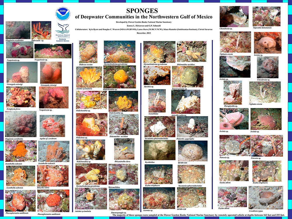
Poster showing the variety of sponges being identified
from samples collected during ROV surveys.
The acquisition of these samples provides images and information that will be used to develop regional catalogs of marine flora and fauna. These catalogs will not only be a useful resource in the Gulf of Mexico, but on a wider Caribbean scale.
top of page